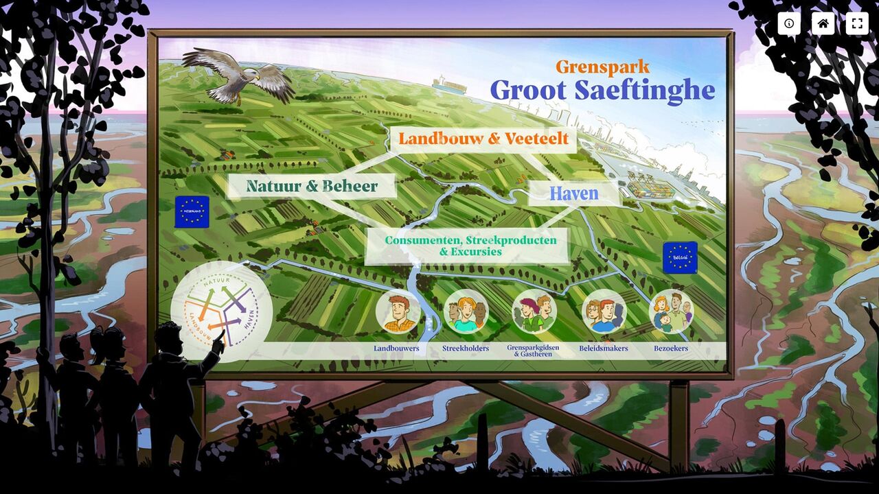
Vision for unique area Grenspark Groot Saeftinghe
All chances and opportunities to put the border region on the map will be seized. Because Grenspark Groot Saeftinghe is more than a nature reserve in the shadow of the harbour. Flatland was asked to sharpen and clarify a future vision of the area with visualisations.
The application: an integrated and sustainable vision of the future
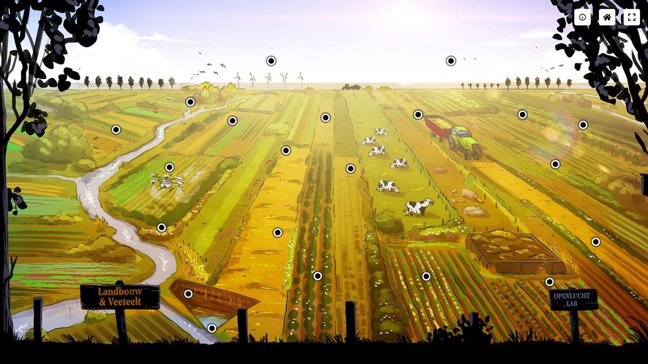
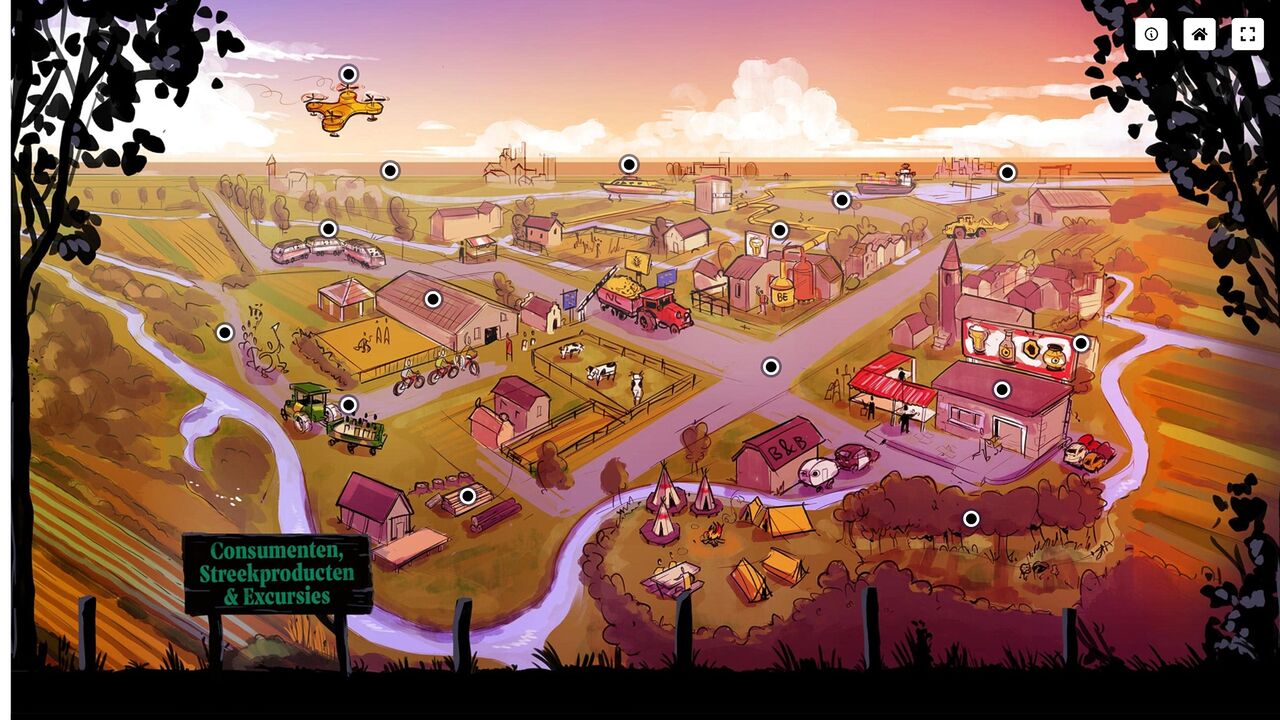
The border park provides space for nature, agriculture and port. Not side by side, but preferably in harmony with each other. And with all these different players (nature managers, farmers, policy officers and delegates from the port), an integrated vision of the future was needed. With room for recreation and industry, but also for a search for new, more sustainable farming methods.
To make these fine words a little more concrete, we worked with all kinds of parties (regional stakeholders) to create clear and expressive visualisations in the form of an interactive.
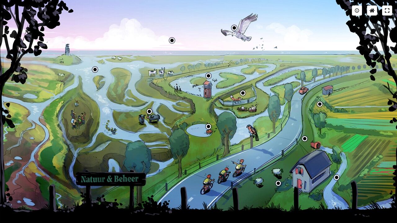
Brown Harrier Project: in search of more biodiversity
The Border Park is experimenting a lot with measures that boost biodiversity. To help mainstream agriculture with this, the Marsh Harrier Project has been launched. Choosing suitable crops and ‘new’ ways of sowing create a friendly habitat for animals like the Marsh Harrier.
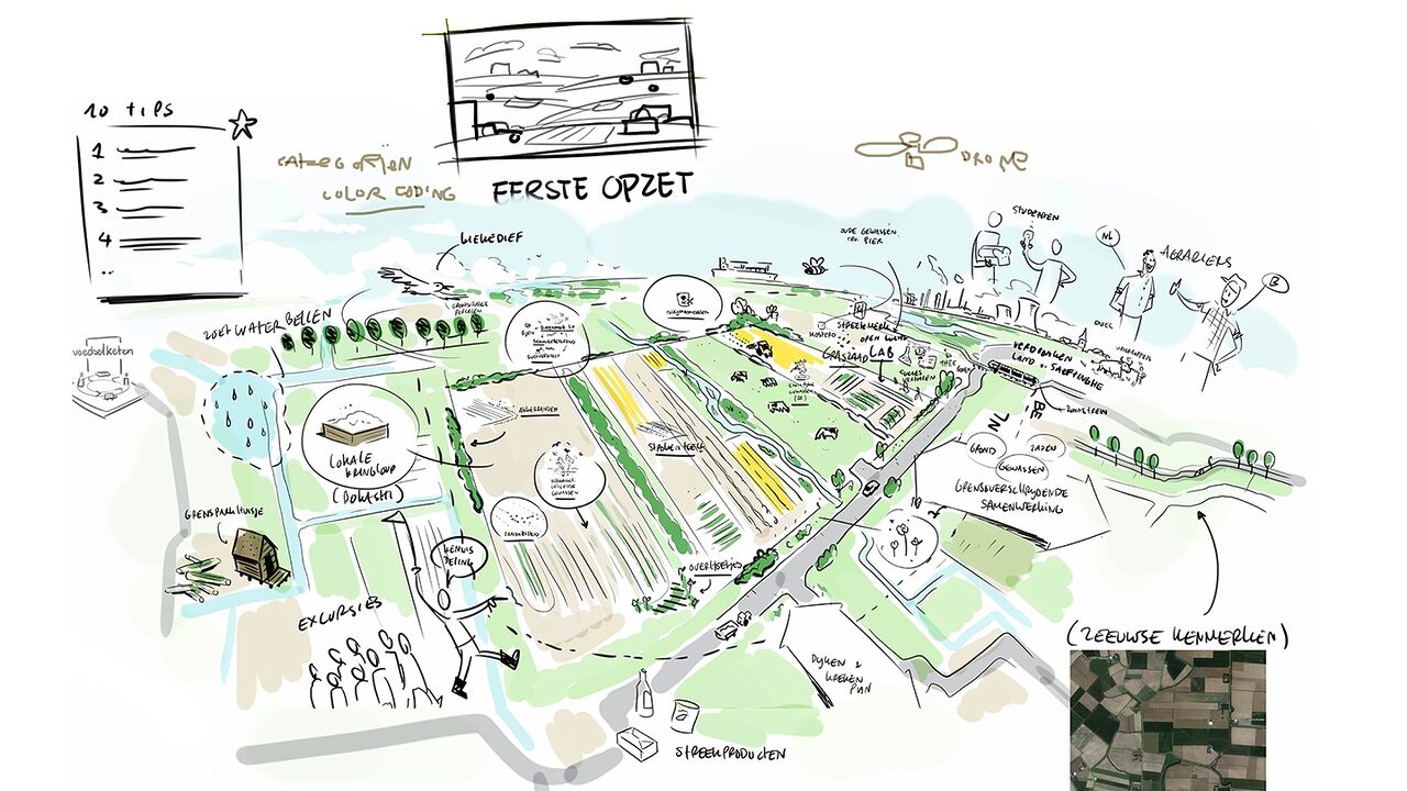
To inform and enthuse farmers and policymakers in the region, they wanted to incorporate all the valuable tips into a visual future plan.
What did the process look like?
The solution
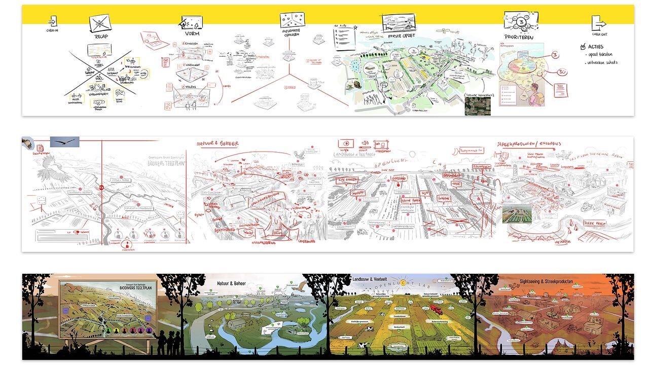
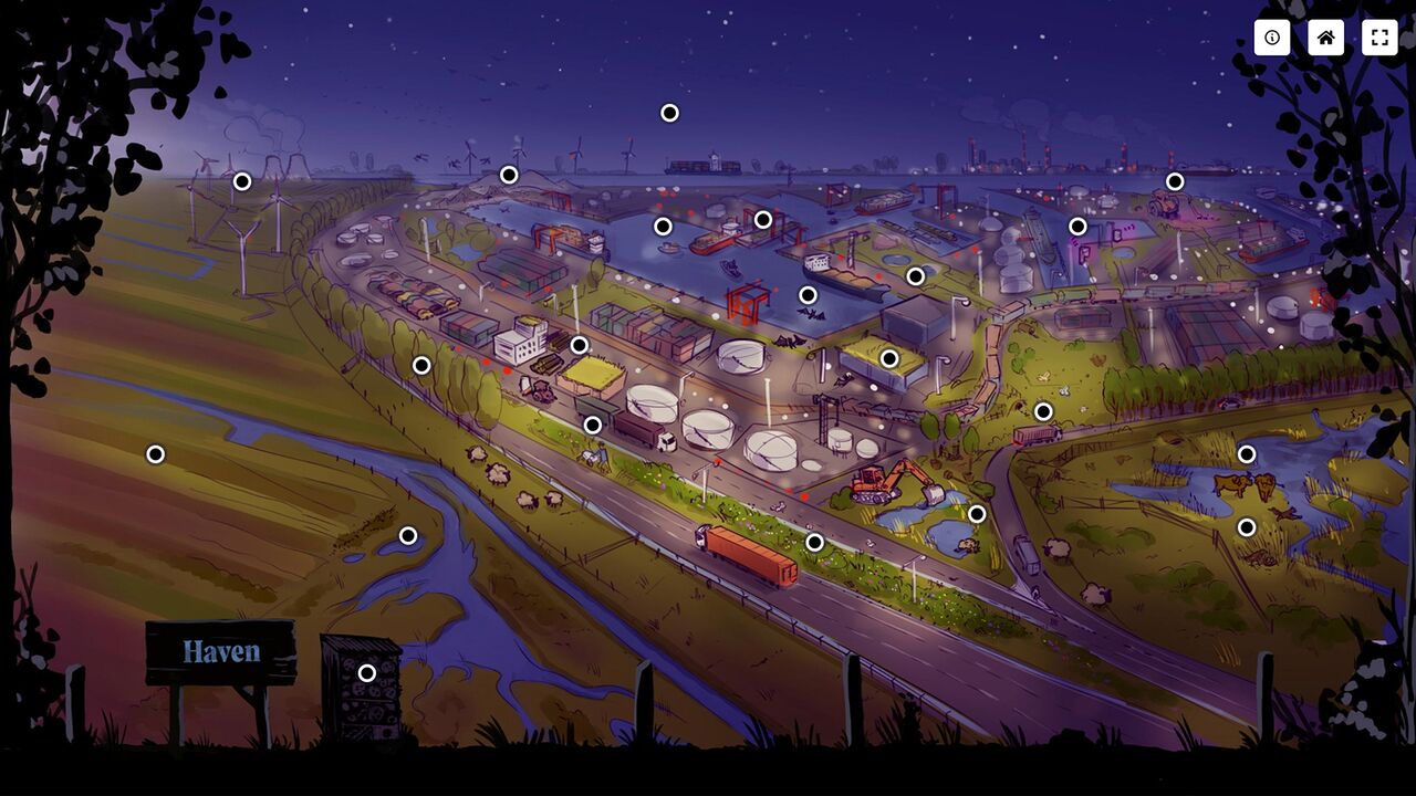
We started by mapping and visualising all topics, themes and players in the area. We did this together with the farmers, regional stakeholders, nature managers, people who think along with the border region, Province of Zeeland and EGTS, a partner from Flanders.
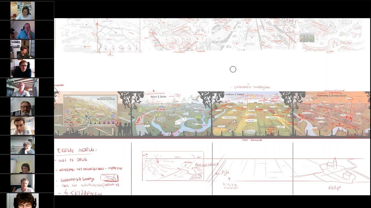
This required several sessions and a lot of time, because it is still quite a challenge to bring many parties to the table at the same time. Fortunately, we can facilitate online sessions, which facilitates the process.
The interactive ensures that the wealth of information and various initiatives are brought together in an orderly fashion. It inspires to look at the area with different eyes, to see what is behind it all and which special partnerships have made the Border Park possible.
Besides the visualisation itself, themutual exchange and conversation between all parties is also a great benefit! The Grenspark provides a participation platform where people engage with each other. Working together yields so much!
The interactive inspires and activates!
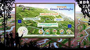
The interactive is actually a very large search board to see everything in the area. Fun for visitors to the Border Park to dive into and discover all kinds of things about the area. And at the same time, it inspires all stakeholders and interested parties to form a picture of opportunities and collaborations. This is the effect of visualisation: a powerful way to clarify a complex plan, make it concrete and get people actively involved.
The area stakeholders are enthusiastic about the result: all the complexity comes together in one image. And they are happy that the area is so recognisable; this is Grenspark Groot Saeftinghe!
How can we support you?
Are you curious about how we can map the future vision of your area in an inspiring way?
Get in touch with Govert.
Visual Designer